.
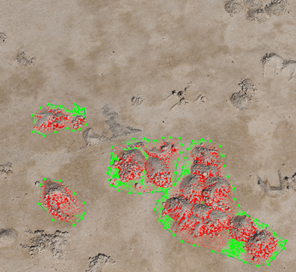
The Survey Data is collected by UAV techniques based on Ground Control Points. This data is processed to shape a 3D Digital Terrain Model (DTM) which forms the basis for Volume Calculations, Surface Area Measurements and Cross Sections.
© Digital data for aerial imaging 2022 ❤